
Updated on October 18, 2026
2,448 miles from the Santa Monica Pier to the “Begin Route 66” sign in Chicago, with the caverns, craters, diners, and roadside giants worth stopping for.
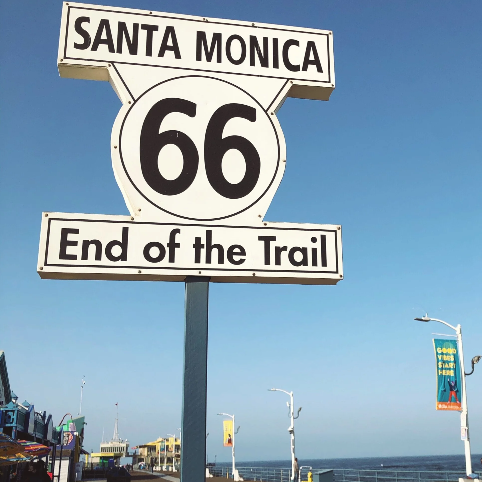
The “End of the Trail” sign on the Santa Monica Pier, where my trip began.
This post may contain affiliate links. If you buy through them, I may earn a small commission at no extra cost to you.
Many of the landmark descriptions in this guide come from Jessica Dunham’s Moon Route 66 Road Trip, the guidebook I used to plan my trip and recommend at the end of this post.
As an author, I believe traveling is an incredible source of inspiration for stories, poetry, and other creative writing, so I couldn’t pass up the opportunity to travel Route 66 in ten days when I was given the chance with my best friend in 2021.
Route 66 in the United States runs 2,448 miles (3,939 km) from Chicago, Illinois to Santa Monica, California. It’s a journey that’s been “paved by pioneers, risk-takers, disruptors, poets, rule-breakers, and adventurers” since 1926. I like to consider myself one of those rule-breakers since I started at the end of the route and made my way to its beginning in Chicago—which is why this guide might seem backward, but it’s great if you’re starting in California like I did.
You could drive down Route 66 for a month and still have things left over to do by the time you’re done. There’s so much to see on The Mother Road, but this guide focuses on the major sights along the way to include National Parks, landmarks, and fun local restaurants. If your time is very limited while traveling this route, then buckle up and let me help you plan your trip!
A note on timing
I took this trip in 2021, when many states and businesses along Route 66 were still affected by COVID-19. A few stops had limited hours or were closed when I visited, and since then, hours, prices, and even some businesses may have changed. If you’re planning this trip today, check each stop’s website before you go.
Route 66 in 10 Days at a Glance
| Day | Stops | Overnight |
|---|---|---|
| Day 1 | Santa Monica Pier, CA · Roadkill Café, Seligman, AZ | Seligman, AZ |
| Day 2 | Grand Canyon Caverns · Sultana Bar, Williams · Grand Canyon South Rim | Flagstaff, AZ |
| Day 3 | Sunset Crater · Meteor Crater · Route 66 Neon Drive Thru, Grants, NM | Albuquerque, NM |
| Day 4 | Albuquerque Old Town · Big Texan Steak Ranch · Cadillac Ranch, Amarillo, TX | Amarillo or Oklahoma City |
| Day 5 | Classen Grill · Centennial Land Run Monument · Pops, Arcadia, OK | Oklahoma City, OK |
| Day 6 | Hard Rock, Tulsa · Cars on the Route, Galena, KS · Whole Hog Café | Springfield, MO |
| Day 7 | Fantastic Caverns · World’s Largest Fork · Trail of Tears Memorial · Red Rocker · Fitz’s | St. Louis, MO |
| Day 8 | Gateway Arch · Cozy Dog Drive-In | Springfield, IL |
| Day 9 | Lincoln Presidential Museum · Oak Ridge Cemetery · Dell Rhea’s Chicken Basket | Chicago, IL |
| Day 10 | Field Museum · Cloud Gate · “Begin Route 66” sign · Lou Malnati’s | End of the road |
Day 1: Santa Monica, California to Seligman, Arizona
Santa Monica Pier and the Last Stop Shop
The Santa Monica Pier opened in 1909 and is considered the end of the trail. However, for this guide, it’s your starting point on Day 1. Enjoy the breeze and Pacific Ocean views as you walk to the end of the pier, and don’t miss your chance to photograph the famous “End of the Trail” sign along the way. You can spend a few hours here dining, shopping, or riding the Ferris wheel at Pacific Park.

The Robert Waldmire tribute board outside the Last Stop Shop.
Before you leave, at the very end of the Santa Monica Pier, you will find The Last Stop Shop. It’s literally the last store on Route 66. In this case, though, it’s the first. After you hit the store, check out the cool board right outside. It’s a tribute to Robert Waldmire, an American artist and cartographer known for his artwork of U.S. Route 66.
Drive to Seligman: about 6 to 6.5 hours (+1 hour for the time zone change)
Roadkill Café and Historic Seligman

Dinner at the Roadkill Café in Seligman. Don’t let the name scare you.
Hopefully, you made it just in time to grab dinner at the Roadkill Café! Now, don’t be intimidated by its name. The food there was absolutely delicious, and the staff was super welcoming. One of the ladies in charge asked my friend and me why we had stopped there, and we told her we were driving Route 66 and had just started that day. She instantly got excited for us and gave us some free postcards from the restaurant. Super nice! Also, locals and tourists love their buffalo burgers. I decided to try the elk though. I was not disappointed!
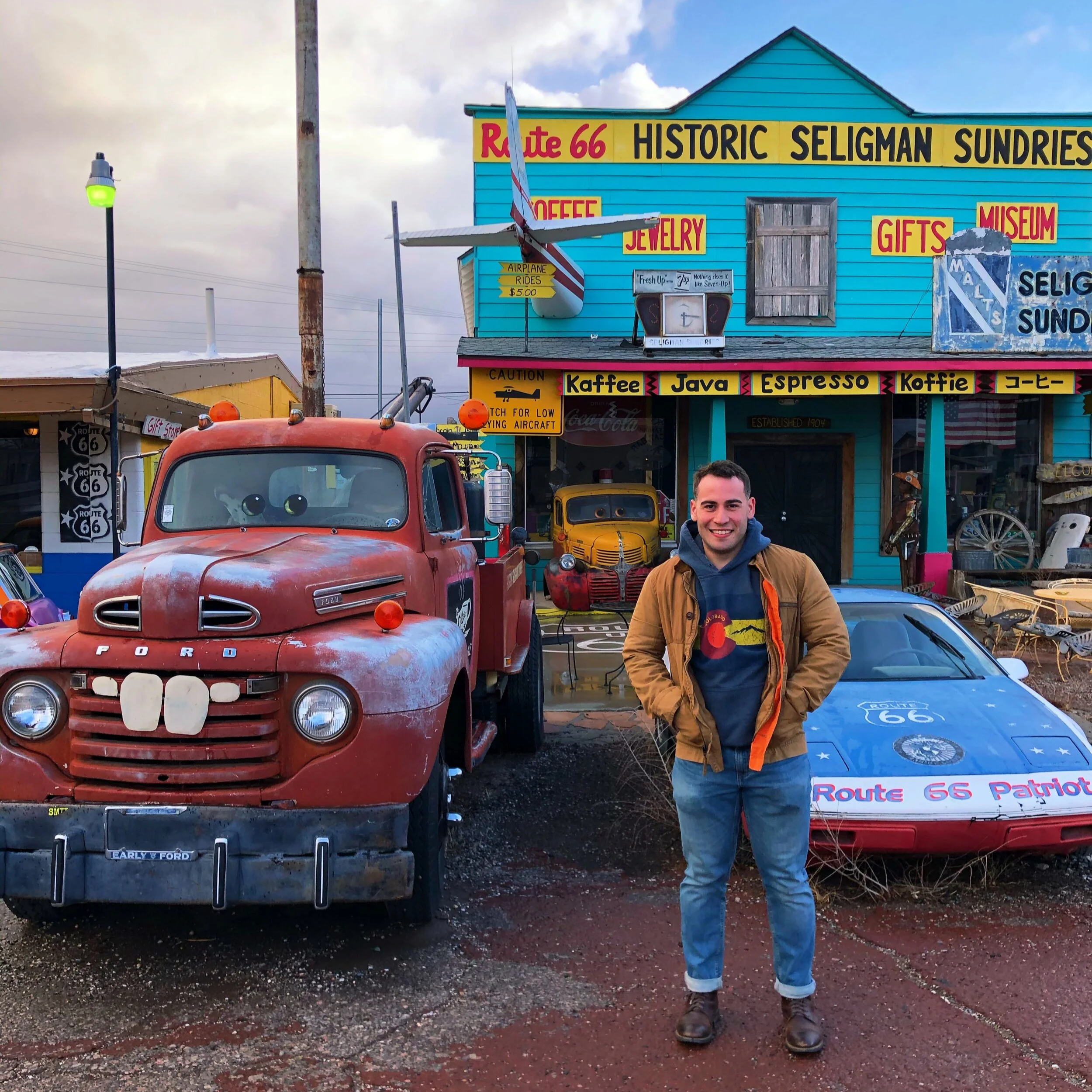
Me in Seligman, Arizona, a one-street town full of Route 66 charm.
Seligman is small, but it’s well known along Route 66, largely thanks to local business owner Angel Delgadillo, who founded the Historic Route 66 Association of Arizona in 1987.
If you can find him in town, I’m sure he can tell you plenty of stories about Route 66. Unfortunately, my friend and I weren’t so lucky, mostly because we weren’t in town for long.
You can visit a series of gift shops in Seligman with quirky displays out front, like a truck resembling Tow Mater from Cars. Be sure to snap all the pictures you need!
You’ll probably want to spend the night in Seligman, Arizona, for some rest. It’s a pretty small town, but there are several motels to choose from. Also, don’t miss the chance to grab a ridiculously delicious breakfast at Westside Lilo’s the next day before leaving town. Their servings were pretty huge, especially for the low price!
Day 2: Grand Canyon Caverns, Williams, and the Grand Canyon
Grand Canyon Caverns
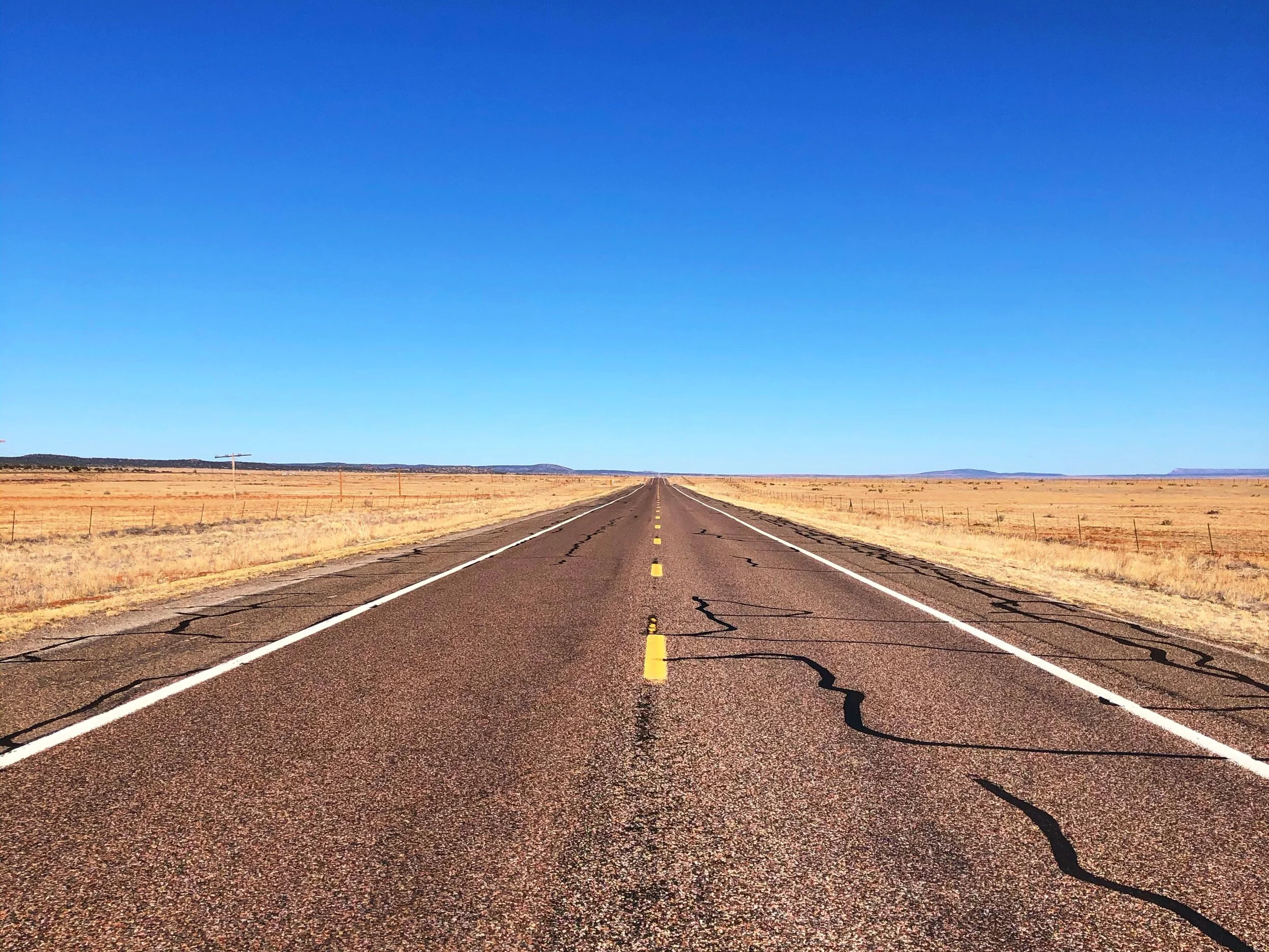
The long, empty Arizona road on the way to the Grand Canyon Caverns.
After you get your huge breakfast at Westside Lilo’s, get ready to make a worthwhile detour. Next, we’re heading to the Grand Canyon Caverns in Peach Springs, Arizona. However, I’d like to take a moment to remind you to enjoy the ride and admire the emptiness of a long Arizona road. Route 66 is all about the journey in between, not just the beginning and the end. So, take in all the views and cherish every moment along the way. It’s about a thirty-minute drive from Seligman. Enjoy it. Isn’t it nice to not have to worry about traffic every once in a while? Also, once this long stretch ends, follow the mile markers so you don’t get lost on your way there!
Once you arrive, your tour will begin with an elevator ride down to the caverns, where your guide will fill you in on the interesting facts about the place. The Grand Canyon Caverns off Route 66 are the largest dry caverns in the United States and range from 200 to 300 feet (61-91 m) deep. I’ll only share a few facts so I don’t spoil your trip!
The caverns were used as a bomb shelter in the past, and you can still find some of the old supplies and rations left in storage down there. Now, the Grand Canyon Caverns are an attraction where local guides offer regular tours, Ghost Tours, and even a chance to stay at their “Cavern Suite,” located 22 stories underground. Spooky. Would you spend the night between 65-million-year-old walls?

The Cavern Suite, 22 stories underground. Would you sleep here?
Did I forget to mention that Ghost Adventures filmed one of their episodes at the Grand Canyon Caverns? Well, I hope it doesn’t make you have second thoughts about your trip here. The only ghost I met was pretty friendly. Don’t forget to ask your tour guide to turn the lights off in the cave so you can see how dark it gets down there!

The only ghost I met in the Grand Canyon Caverns was a friendly one.
By the time you finish your tour, you might not be extremely hungry, but you might be thinking about what’s coming for lunch (if you’re anything like me). No worries! From Peach Springs, Arizona, we’ll be heading to Williams, Arizona, where you will get to visit the world-famous Sultana Bar. The lunch there was fantastic!
Drive to Williams: about 1 hour
The World Famous Sultana Bar in Williams

Me outside the World Famous Sultana Bar in Williams, Arizona.
After about an hour’s drive from the Grand Canyon Caverns, you’ll arrive in Williams, Arizona! This mountainside town sitting at 6,780 feet (2,067 m) was originally settled by sheepherders in 1874. The town is in the heart of the Kaibab Forest and used to be a hub for ranching, lumber, and railroad workers. With them came saloons, opium dens, and gambling parlors. Life is much less crazy there now, which brings us to our next stop.

Inside the Sultana Bar, home of the Carnivore Nachos.
Before we get started on a few facts about the Sultana Bar, I absolutely recommend the Carnivore Nachos. Now, go have some lunch (and a drink) while you read!
The Sultana Bar is housed in an early 20th-century building and claims the longest-operating liquor license in Arizona. It operated as a speakeasy during Prohibition, and supposedly has a trapdoor that leads to underground tunnels that housed an opium den and were used by bootleggers and outlaws in the past. Crazy. What are your thoughts? Are those nachos good?
Before you leave Williams, Arizona, take your time and go visit some of the shops along its long stretch of road. Not too far from the Sultana Bar, you’ll find a big “Williams, Arizona Route 66” mural painted on the side of one of the buildings. Don’t miss out on the photo opportunity! Then whenever you’re ready, pack up and get ready for one of the most iconic stops of your trip: The Grand Canyon.
Drive to the Grand Canyon South Rim: about 1 hour
The Grand Canyon South Rim
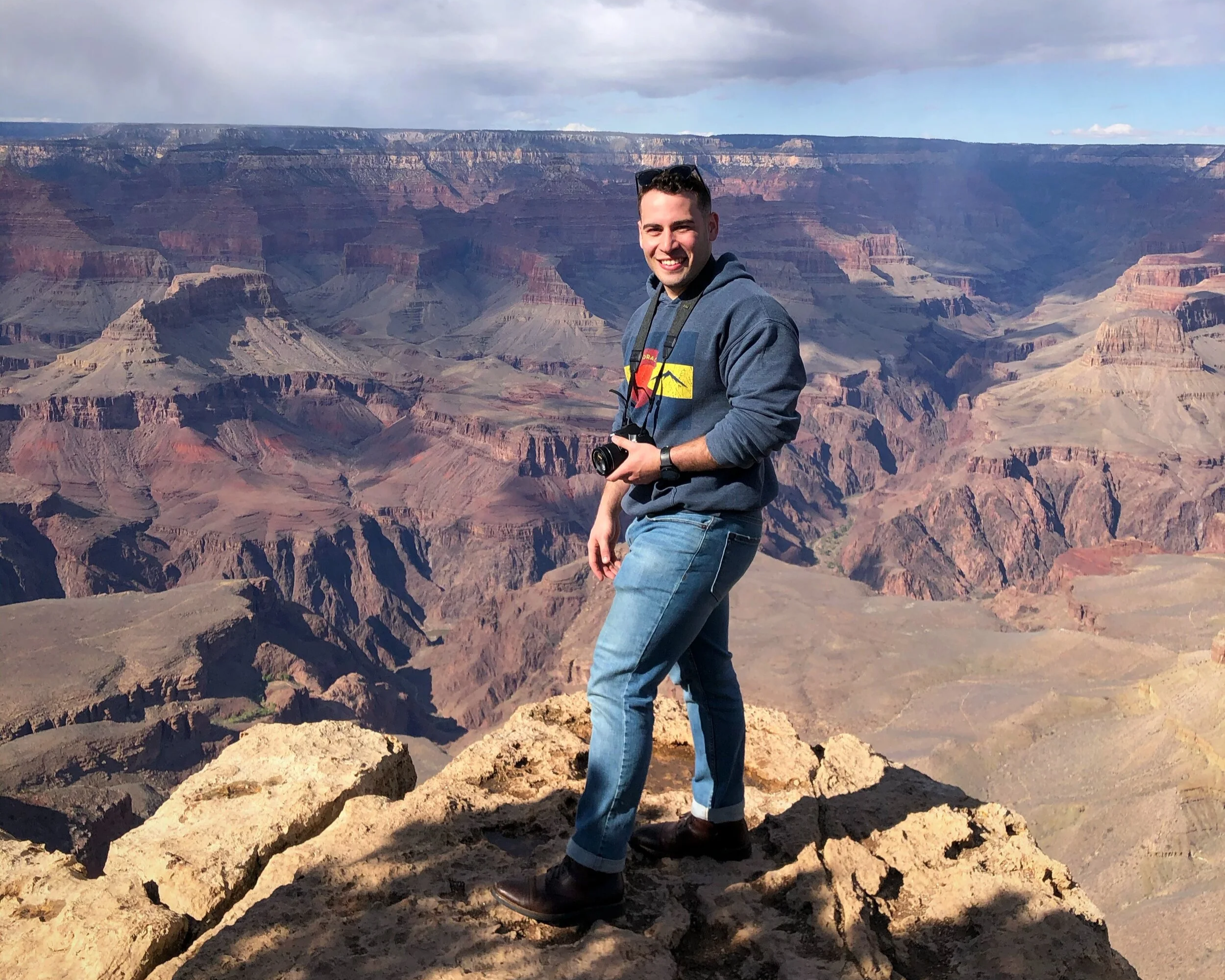
Me at the Grand Canyon’s South Rim, still one of my favorite stops of any trip.
This will forever be one of my absolute favorite stops out of all my trips. After about another hour of driving, you will reach the Grand Canyon’s South Rim. Pictures don’t do the Grand Canyon and its immensity any justice, so this is a stop you cannot miss. You have to see it for yourself.
Did you know the Grand Canyon National Park is 277 miles (445 km) long, 18 miles (29 km) wide, and 1 mile (1.6 km) deep?
The first Europeans to see it weren’t nearly as impressed as I was. In 1540, Spanish explorer García López de Cárdenas stood on the South Rim, looked out over almost 2 billion years of geology, and saw nothing but a desert wasteland in his way. He and his 12 men spent three days searching for a path down to the Colorado River and never found one. Hopi guides eventually convinced them to turn back, and some historians believe the Hopi knew exactly how to reach the river and were protecting a sacred place.
My question is, if the story is true, how could that man not be impressed by this wonder?
Side note: If the canyons of the Southwest have you hooked, Zion National Park in Utah is another one you have to see in person. I wrote about my trip there in The Soul Craves Adventure: My Las Vegas to Zion Road Trip.
When you’re ready to say goodbye to the amazing views, head to Flagstaff, Arizona, and get some rest for the night. The fastest route is probably to head south all the way to Williams again, then take I-40 East. However, if you’re willing to add a few minutes to your drive, I recommend taking US-180 at the Grand Canyon Junction to Flagstaff for a beautiful and breathtaking scenic route through some of Arizona’s forest. It's about a 1.5-hour drive.
Also, if you’re not planning on staying at hotels every night, I recommend stopping at the Little America Travel Center in Flagstaff for the night. They have food, Wi-Fi, and really clean showers available for travelers. Route 66 is full of travel stops like these, so keep an eye out for them if you’re willing to sacrifice a hotel bed for more cash in your wallet.
Day 3: Sunset Crater, Meteor Crater, and Grants, New Mexico
Sunset Crater Volcano National Monument
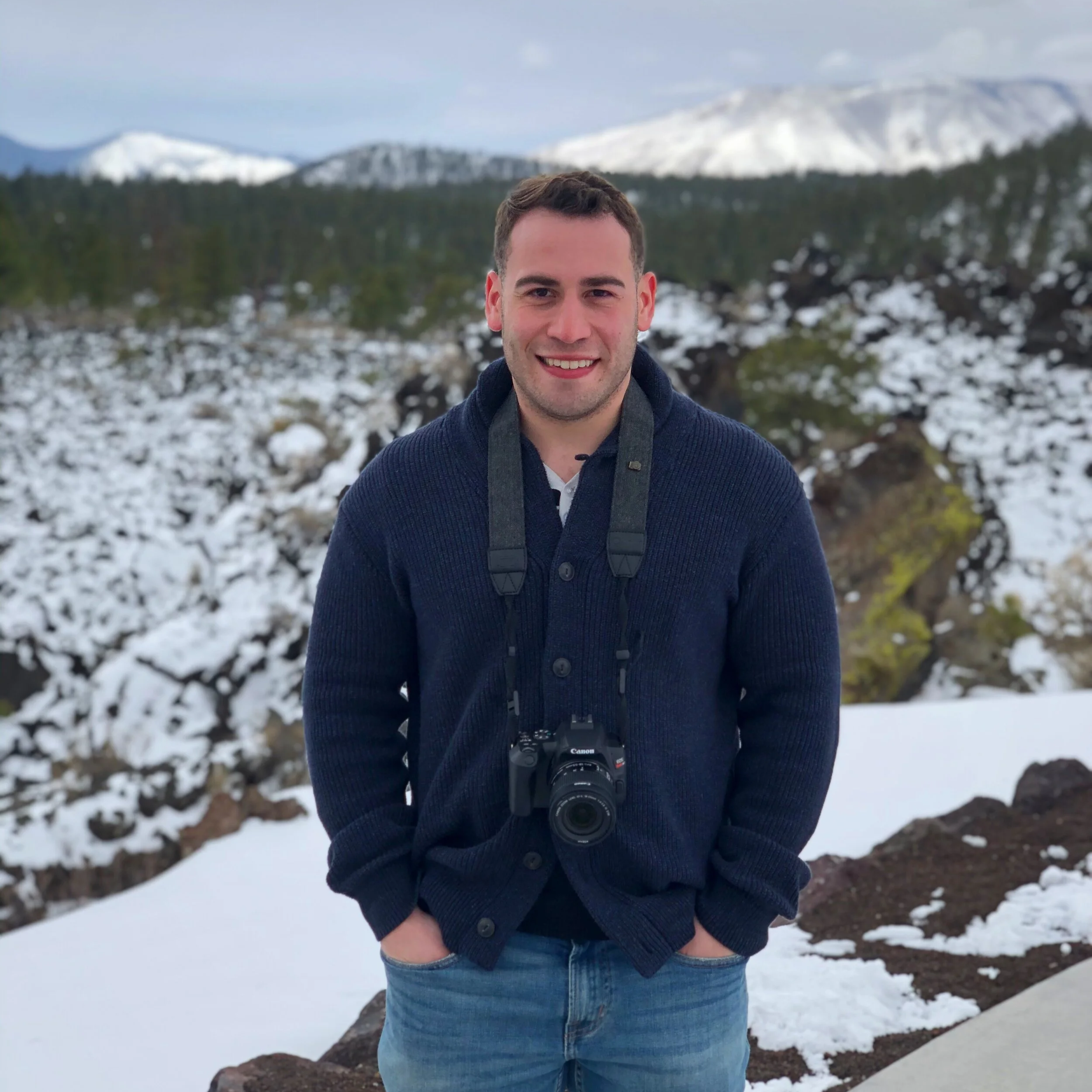
Me at Sunset Crater, with snow still on the ground.
Just north of Flagstaff lies the area’s youngest volcano. Sunset Crater erupted about 900 years ago, which is practically yesterday in geologic time, and buried the landscape around it in black cinders. The 34-mile (55-km) scenic loop through the national monument takes you right past the cinder cone, and it’s wild to think that the more than 600 hills and mountains in this volcanic field were all formed by the same kind of forces.
The cone itself stands about 1,000 feet (304 m) tall. Molten rock sprayed out of a crack in the ground, cooled in midair, and rained back down as cinders and rocks until they piled up into the volcano you see today. The lightest ash was carried by the wind and dusted 800 square miles (1,287 sq km) of northern Arizona.

The visitor sign at Sunset Crater, with the trails and the scenic loop.
If you’re short on time during your trip, you might not get the best view of Sunset Crater. To get the best view, you’ll have to hike the 9.6-mile (15.4-km) O’Leary Peak Trail within the park. Don’t be discouraged, though! You can still do a driving tour of the Sunset Crater Volcano National Monument and Wupatki National Monument in about two hours or less.
The same processes that created Sunset Crater also created a sculpture garden of extraordinary forms at its base, which you can appreciate along the 1-mile (1.6-km) Lava Flow Trail located just a few minutes down the road from the park’s Visitor Center.
Once you’ve enjoyed the views at Sunset Crater Volcano, then you can either head straight to your next destination or (if you’re like me and like bookstores) you can head back to Flagstaff and visit Bookmans Entertainment Exchange.
My favorite part about road-tripping is visiting used book stores. Reasons why?
Books are typically in extremely good condition or practically new but still sold way cheaper at these stores.
Many used bookstores are pretty old and have a lot of history behind them.
When you buy books at these stores, you’re usually supporting a local business.
However, if this isn’t your thing, then get ready for your next stop: Meteor Crater.
Meteor Crater Natural Landmark
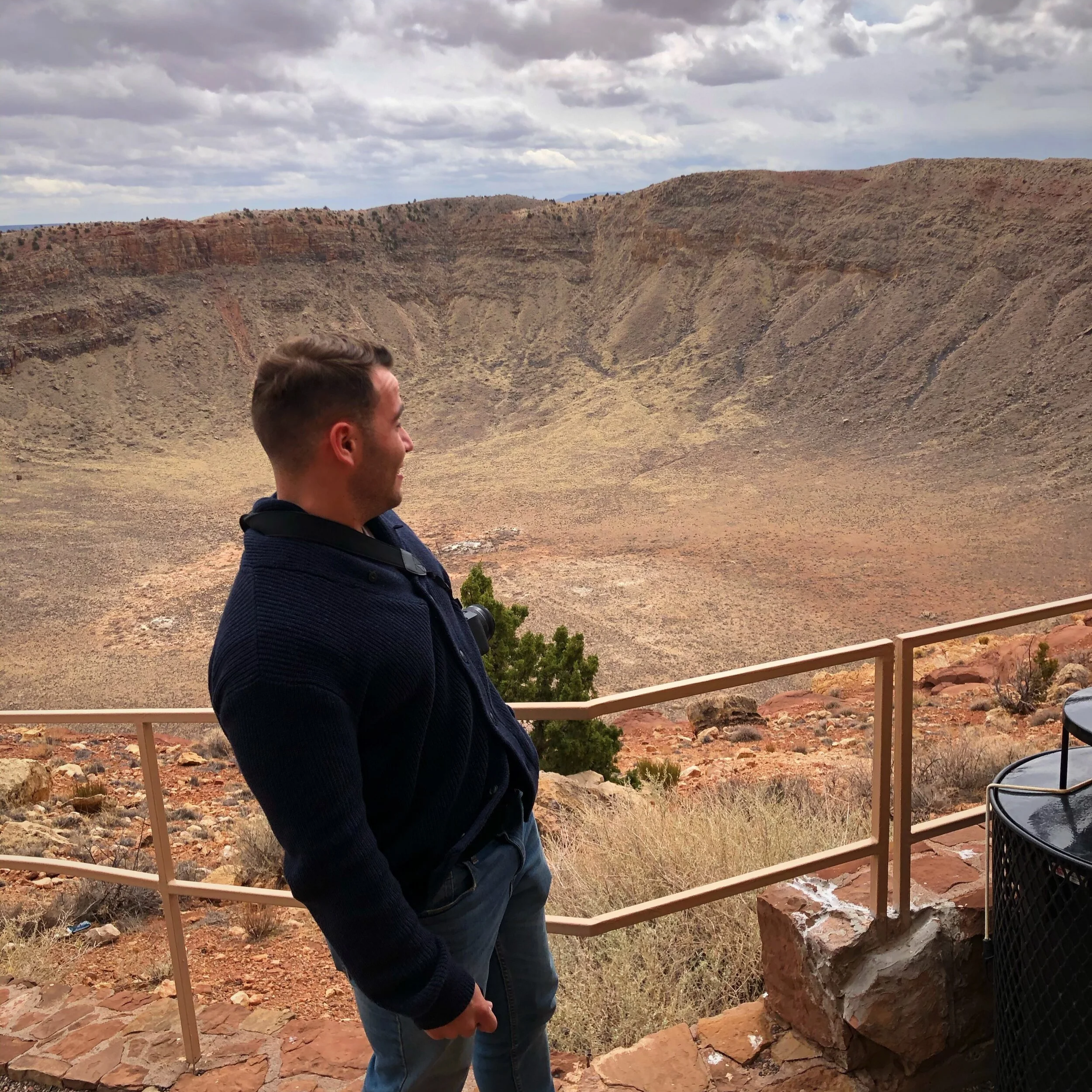
Me at the rim of Meteor Crater. Another big hole in the ground, but worth it.
Yes, I know. It seems like we’re just spending the day looking at big holes in the ground. But this one is worth it. Trust me. Less than an hour’s drive from Flagstaff, you will reach the famous Meteor Crater Natural Landmark in Winslow, Arizona.
Picture this: 50,000 years ago, a meteor weighing several hundred thousand tons traveled through space for 500 million years before crashing into Earth at 26,000 miles per hour (41,840 kph). Hard to believe? See for yourself the 550-foot-deep (168-m) hole it left at Meteor Crater. It’s the best-preserved meteorite impact site on the planet.
Also, don’t miss out on the on-site museum! It has interactive exhibits, a fascinating history of meteorite activity on Earth, and a film theater.
I hope you enjoyed Arizona! Once you’re done at Meteor Crater, pack up and get ready for a long drive. We’re heading to New Mexico!
Drive to Grants, New Mexico: about 3 to 3.5 hours
Historic Route 66 Neon Drive Thru Sign in Grants
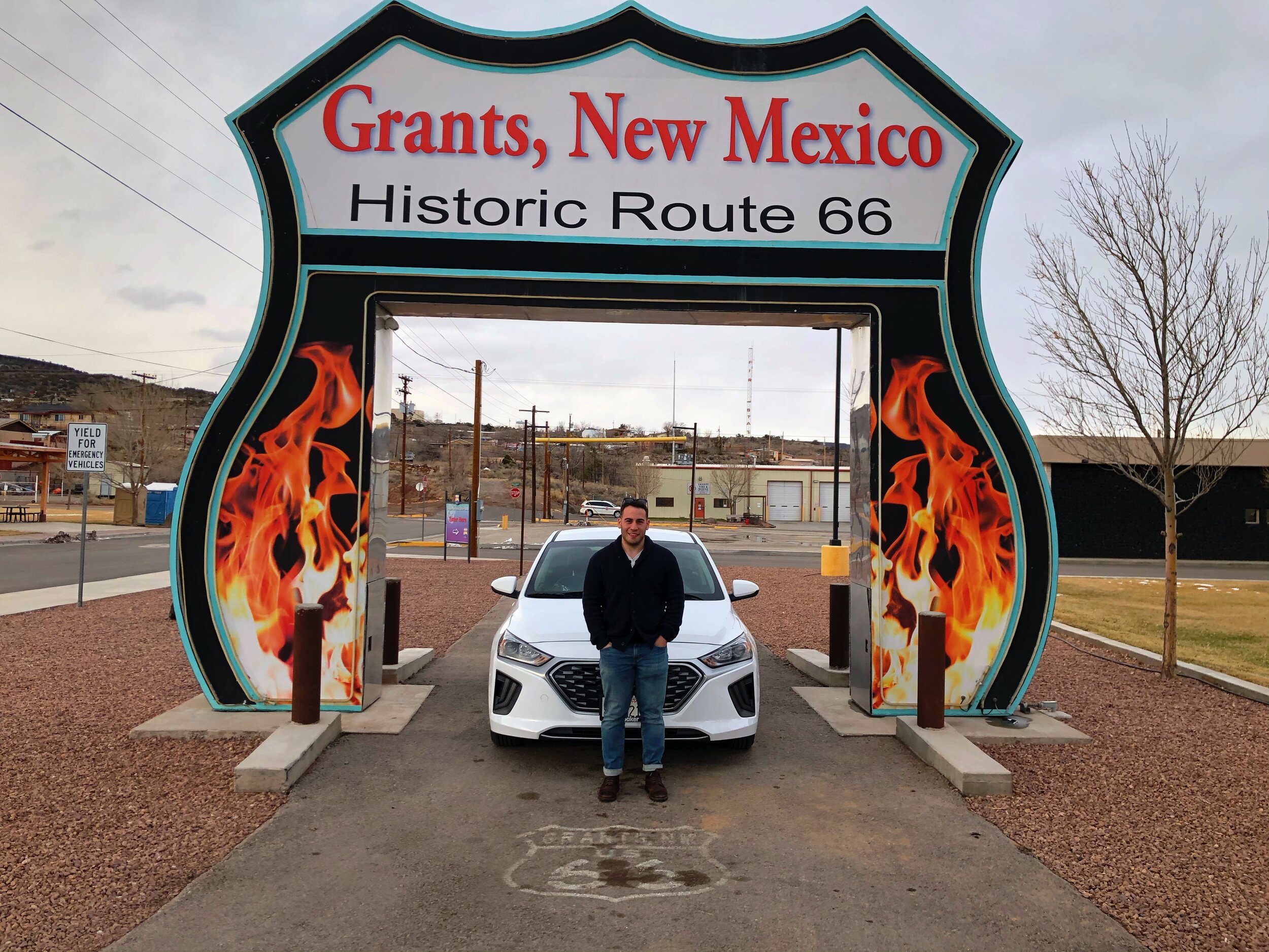
Parked under the Route 66 Neon Drive Thru in Grants, New Mexico.
After a 3- to 3.5-hour drive from Meteor Crater, you’ll reach Grants, New Mexico, where you can park your vehicle under the famous Route 66 Neon Drive-Thru. It’s a quick stop here, but you don’t want to miss the photo opportunity! Pull your car through the 18-foot-tall (5.5-m) arch shaped like a Route 66 sign—colorful by day and illuminated by night—and snap all the pictures you like.
Once you’re done, we’re heading to Albuquerque and getting some rest for the night. It’ll be another 1 to 1.5-hour drive, so if you’re hungry when you arrive, I recommend grabbing dinner at the 66 Diner. The food there was delicious! Also, don’t forget to look up in the restaurant and see the rows of PEZ dispensers used as decorations.
Day 4: Albuquerque, New Mexico, to Amarillo, Texas
Albuquerque Historic Old Town
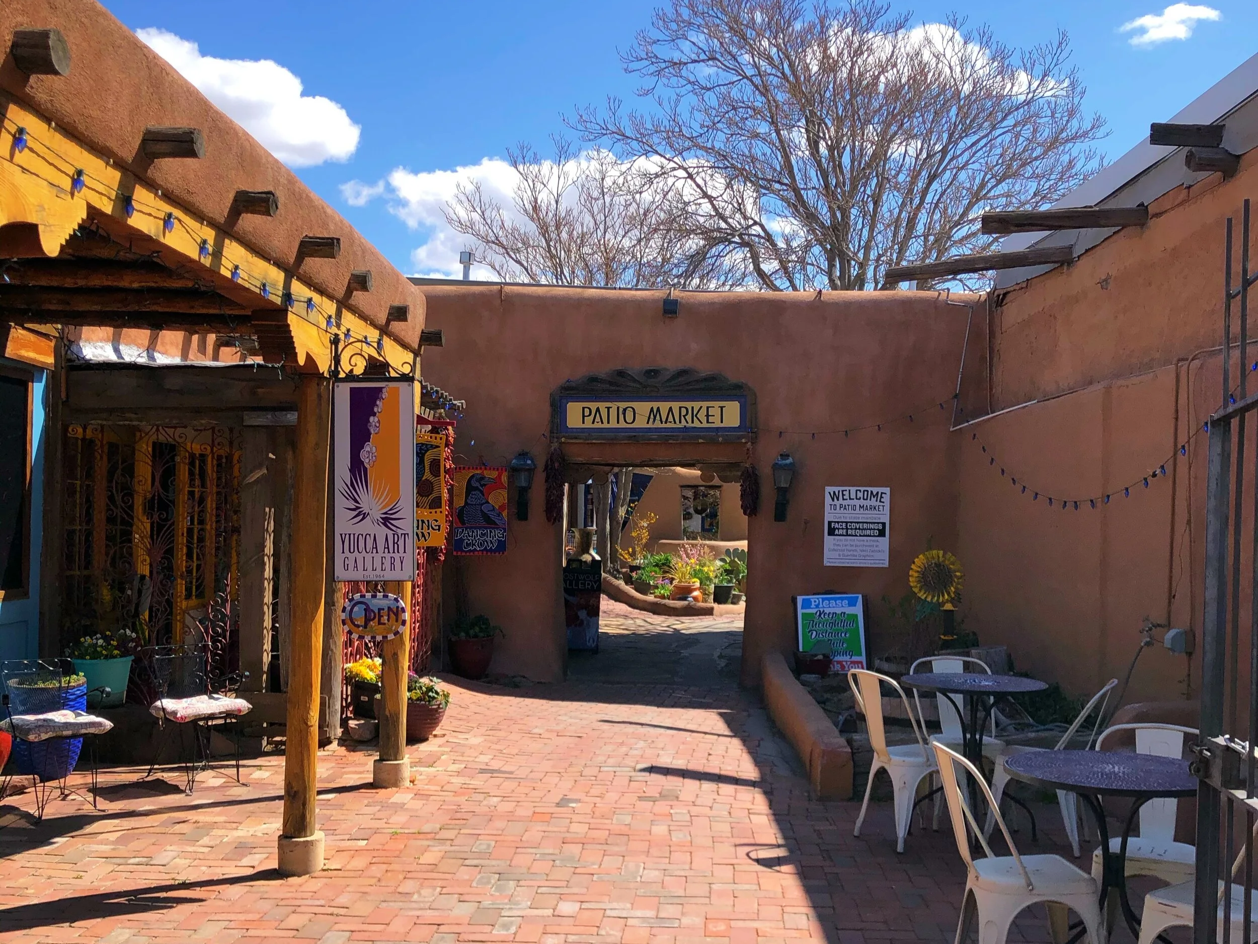
A quiet corner of Albuquerque’s Historic Old Town.
The Old Town has been the heart of Albuquerque, New Mexico, since the city was founded in 1706. Today, it’s the city’s cultural center, with numerous museums and more than 100 shops, galleries, and restaurants. After breakfast, spend a few hours exploring the area and buy some souvenirs.
Unfortunately, when I visited, some museums were closed or had restricted hours due to COVID-19, so I wasn’t able to do everything I planned for the trip. I hope it’s different and safer for you, though, whenever you stop by! Still, I got to walk past a group of older gentlemen gathering in the square to play music, and I had to stop for a moment. It reminded me that even in the midst of chaos, life is often about enjoying the simple things.
Finally, if you’re like me, then you’re probably looking for those small bookstores. Head over to the slightly hidden Treasure House bookstore by the Old Town Square and support the local business!
Unless anything else catches your eye in Albuquerque, get ready because you’re about to complete a 4 to 5 hour drive to Amarillo, Texas. Say goodbye to the Historic Old Town and say hello to some of the best food you’ll have on your trip at the famous Big Texan Steak Ranch.
The Big Texan Steak Ranch

The Big Texan Steak Ranch in Amarillo, home of the free 72oz steak challenge.
Yes, everything is bigger ‘n Texas, especially in Amarillo, Texas. I hope you worked up an appetite on your drive because you’re in for some delicious food at this famous restaurant along Route 66. One reason it’s so famous is its free 72oz steak dinner. Yes, I said, “FREE.” There is a catch, though…
The free 72oz steak dinner legend was born in 1960 on Route 66 (not long after founder R.J. “Bob” Lee opened The Big Texan Steak Ranch). History has it that a table full of hungry cowboys competed for Big Texan bragging rights by eating 1-pound steaks over a 1-hour period.
When the hour ended, 1 cowboy had eaten four and a half 1-pound steaks (totaling 72 oz), shrimp cocktail salad, a baked potato, and bread. Lee grinned and vowed that, from that day forward, the dinner would be free to anyone who could eat it in 1 hour. Can you do it?
Cadillac Ranch

Cadillac Ranch and its decades of spray paint, just west of Amarillo.
Not all art lives in a museum. Some of it is planted nose-first in a Texas wheat field. About 10 miles (16.1 km) west of Amarillo, not far from The Big Texan, you’ll find Cadillac Ranch: 10 tail-finned Cadillacs built between 1948 and 1964, buried halfway into the dirt in a row like dominoes that never fell.
Over the past several decades, the cars have become defaced with layers of spray paint to the point that they barely resemble Cadillacs anymore.
Hudson Marquez, one of the artists who designed and built Cadillac Ranch, said he wishes the site was more protected and that people wouldn’t litter and spray paint the cars. So, for this one, although other Route 66 guides may encourage you to continue this tradition, it’s probably a better idea to keep the site clean and safe for other travelers. Leave the spray paint at home.
Once you’re done snapping all your pictures at Cadillac Ranch, we’re getting some more driving in before the day is over and heading to Oklahoma City. When you arrive, you can enjoy the nightlife at Bricktown, or get some well-deserved rest for the day ahead.
Day 5: Oklahoma City and Arcadia, Oklahoma
Breakfast at the Classen Grill

The Classen Grill in Oklahoma City: cheap menu, enormous portions.
Either you decided to rest in Amarillo for the night, or you made the trip to Oklahoma City. Regardless, I bet you’re hungry and ready for breakfast! Hopefully you made it to Oklahoma City, because I absolutely recommend grabbing breakfast at the Classen Grill. It’s a relatively small restaurant, but it only adds to its cozy environment and friendly service. The menu is super cheap, but the portions are enormous! This is always a plus if you’re a big eater like me.
The Centennial Land Run Monument

Part of the Centennial Land Run Monument along the Bricktown Canal.
After breakfast, head over to Bricktown. Next, the Centennial Land Run Monument features 36 life-size sculptures (artist Paul Moore) that reenact the Land Rush. More sculptures are being added each year, and when completed, it will be one of the largest freestanding bronze sculptures in the world. The artwork captures the intense energy of the event in impressive detail, but it should not be overlooked that the moment in history the monument depicts is one that ripped away land from tribal members, forever changing their lives.
The monument is located in the South End of Bricktown Canal and follows a quiet walk along the flora and water. If you’re a photographer, you can easily spend an hour or two snapping a million pictures here and exploring Bricktown further. There are several bars and restaurants along the way too, but once lunch or dinner time starts coming around, I actually recommend making a drive over to Pops for an experience.
Pops in Arcadia

Soda bottles lining the windows at Pops in Arcadia.
You’ll be impressed by the carbonated sugar drink offerings at this place in Arcadia, Oklahoma. Since this soda utopia opened in 2007, it’s become a favorite spot on Route 66. Pops has to be the most unique gas station in America. A colossal 66-foot-tall (20-m), LED-lit bottle sculpture rises above the horizon, inviting travelers to stop at the neo-futuristic service station designed by Rand Elliott. Inside, the walls shoot overhead at a sharp angle, and colorful bottles of soda line the windows in perfect succession. It’s also a diner: Pops serves breakfast all day, plus burgers and shakes. It’s usually crowded here, so plan for a wait and arrive before you’re extremely hungry. There’s a gift shop inside too, so be prepared to buy some souvenirs!
Once you’re done here, take the rest of the evening to rest or to enjoy the nightlife in Bricktown. You’ll have plenty of driving the next day.
Day 6: Tulsa, Oklahoma to Springfield, Missouri
Hard Rock Hotel & Casino in Tulsa
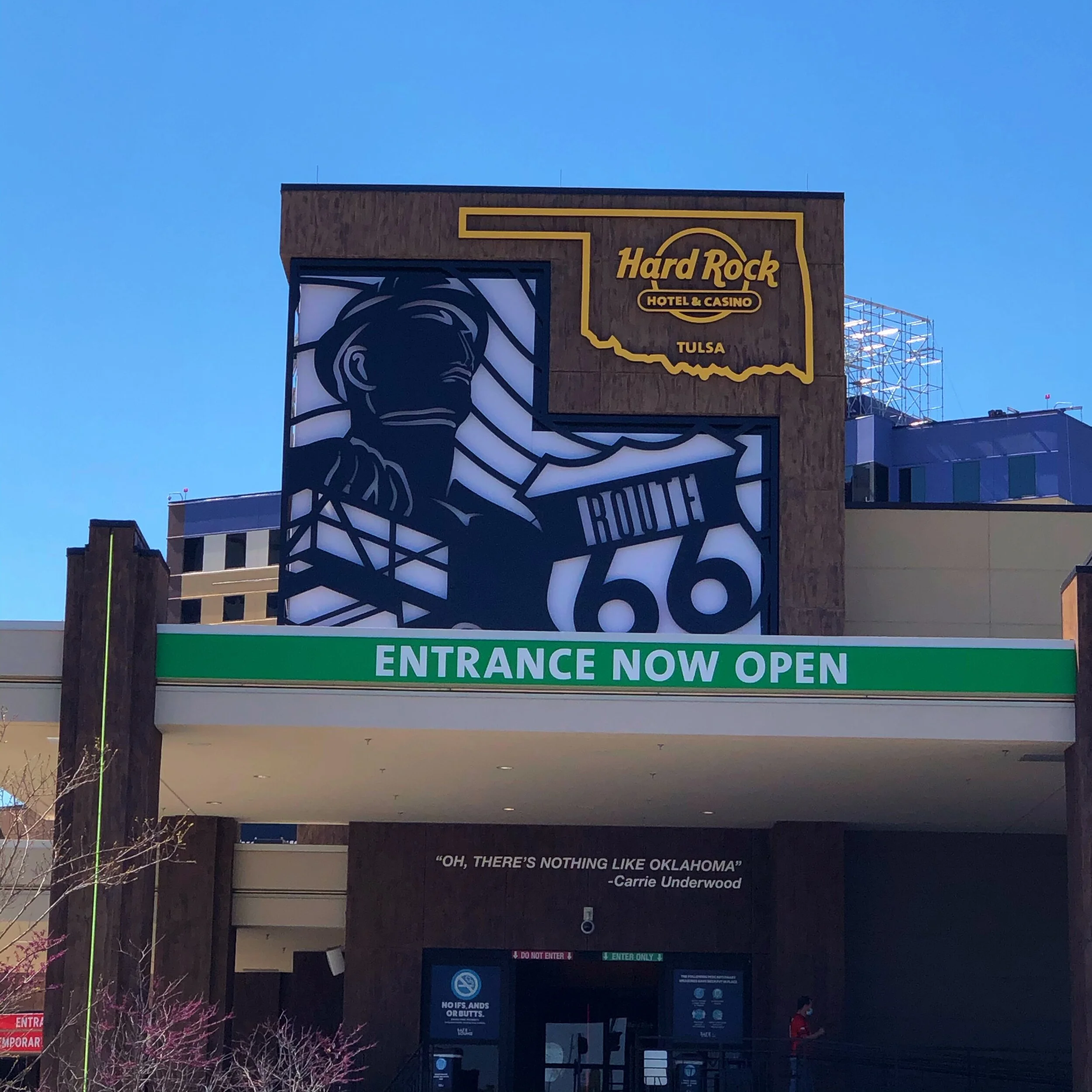
The Hard Rock Hotel & Casino in Tulsa, a must for souvenir collectors.
Hard Rock started in 1971, when two Americans living in London, Isaac Tigrett and Peter Morton, couldn’t find a good American burger anywhere. So they opened their own American-style diner in an old Rolls-Royce dealership and called it Hard Rock Cafe. Today, the brand has locations in more than 70 countries, including a hotel and casino right off Route 66 in Tulsa.
Hopefully you’re well-rested and full from breakfast. The trip today starts with about a 2-hour drive to Tulsa, where you will arrive at the Hard Rock Hotel & Casino. This may be an optional stop for you, but if you’re like me, then you like collecting souvenirs. I collect patches for my backpack, and my friend (who made this trip with me) collects the Hard Rock Hurricane Glasses, so we had to make the stop! Also, the Route 66 design at the casino entrance is worth a quick stop for pictures. It’s along the way anyways, so why not!
Drive to Galena, Kansas: about 1.5 to 2 hours
Cars on the Route in Galena, Kansas

Me with the old trucks at Cars on the Route in Galena, Kansas.
Are you a Pixar fan? If not, this is still a memorable and pretty famous stop along Route 66 that you shouldn’t miss. About another 1.5 to 2-hour drive from Tulsa, you’ll arrive in Galena, Kansas, where you will find some friendly characters parked outside an old service station.
Meet the 1951 International boom truck that inspired Tow Mater, the lovable character from Pixar’s Cars. In addition to the 1950s boom truck, a replica decorated to look exactly like Tow Mater—with eyes and buck teeth—is parked next to it. For trademark reasons, the replica is named Tow Tater.
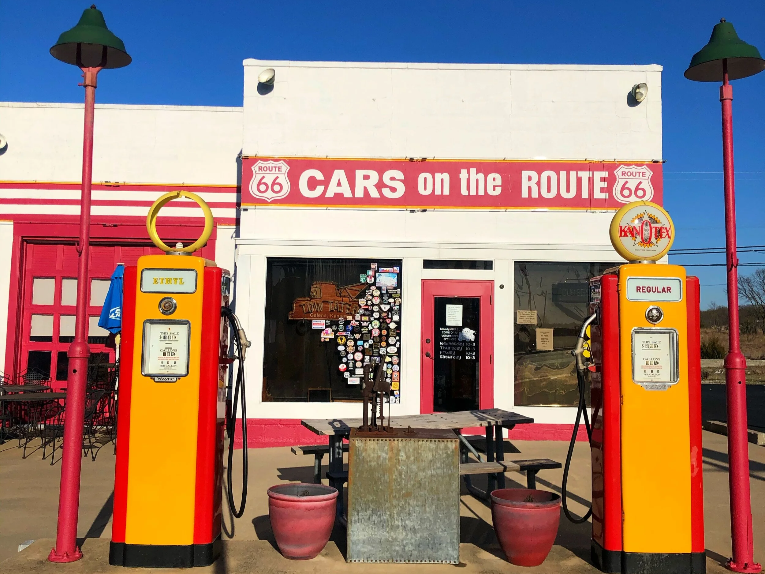
The old service station at Cars on the Route.
Right by “Tow Tater” you’ll find a plaque with some background on the inspiration for Tow Mater. In all honesty, it captures not only the character’s essence, but also Route 66 itself, the friendly people you meet along the way, and the generous American spirit that still lives on in small towns across the country. The plaque says the following:
“In Galena, Kansas, we found a lonely old tow truck that most folks would pass by without a second glance. Our Head of Story, Joe Ranft, however, saw the inspiration for the character Mater. They soon became kindred spirits. Joe gave Mater his warmth, his sense of fun, his humble and generous spirit, and his capacity to see and bring out the best in others.”
If you’ve had the chance to speak with locals along the way, you may have experienced warm interactions that are uncommon in “big city life.” It’s one of the things I’ve enjoyed most about the trip so far.
Whole Hog Café in Springfield

The Whole Hog Café in Springfield, some of the best food of the whole trip.
So we’ve gone from California to Arizona to New Mexico to Texas to Oklahoma to Kansas, and now… Springfield, Missouri. About another 1.5-hour drive away from Cars on the Route, you’ll find the perfect way to start a new experience in another state: some amazing food at the Whole Hog Café.
The Whole Hog Café is one of Springfield’s best barbecue spots. The Hog has won awards for its dry-rubbed meat, and it has six house-made sauces—all of which are delicious. Do not miss this stop for lunch or dinner! And come hungry, as plates such as pulled pork, burnt ends, and beef brisket come with two hearty sides and a dinner roll. It was some of the best food my friend and I had on the whole trip.
We arrived later in the evening, so after we finished eating, we decided to get some rest for the night. However, if you’ve been extra speedy with your driving (safely, I hope), go explore Springfield some more before the day is done!
Day 7: Springfield to St. Louis, Missouri
Fantastic Caverns

Inside Fantastic Caverns, just north of Springfield.
Y’all thought I was done with caves on this trip! I recommend starting the day with breakfast at George’s Family Restaurant. Right after, get ready for another interesting underground tour.
Located about 5 miles (8 km) north of Springfield, Missouri, Fantastic Caverns offers a jeep-drawn tram that takes visitors on a ride into the cave. You’ll see fluted, draped stalactites, stalagmites, and flowstones, all beautiful and creepy in their otherworldliness.
The truly creepy thing about this cave, though, is that the Ku Klux Klan once conducted secret meetings and cross burnings in the cave in the 1920s. The tour guides have much to teach about these natural formations and their history. And if you’re lucky, they’ll point out to you a formation that looks like what they call the “Scooby Doo Monster.” Don’t miss this stop when traveling through Missouri on Route 66!
The World’s Largest Fork

Me with the World’s Largest Fork. Imagine the dinner.
Before heading here, you can also check out Bookmarx in town if you’re into used bookstores. It was one of my favorites on the trip! If not, then get ready for some enormous eating utensils right after Fantastic Caverns.
The World’s Largest Fork, almost 5 miles (8 km) south of downtown Springfield, Missouri, is, well... pretty self-explanatory. The fork stands 35 feet (11 m) tall and weighs 11 tons (10 metric tons). Colorado also claims to have the world’s largest fork, but regardless, this is one of those odd Route 66 attractions worth stopping for—take a picture.
Imagine the kind of dinner you’re having if you’re using a fork that big...
Drive to Jerome, Missouri: about 1.5 hours
Larry Baggett’s Trail of Tears Memorial
Unfortunately, all my pictures from this site were deleted somehow, but my buddy saved me by sending me this picture he snapped on his phone.

The stone archway at Larry Baggett’s Trail of Tears Memorial. Photo by my best friend.
After about a 1.5-hour drive from The World’s Largest Fork in Springfield, you’ll arrive at Larry Baggett’s Trail of Tears Memorial in Jerome, Missouri. When you arrive, park on the side of the road. Even though it looks like a driveway, this memorial is a walking trail.
Segments of Route 66 from Rolla to Springfield follow the 1838 Trail of Tears. This was the northern route on which U.S. troops forced tens of thousands of Cherokee, Creek, Seminole, Chickasaw, and Choctaw to walk 1,200 miles (1,931 km) across the country to reservations in Oklahoma. At least 4,000 died from disease, exposure, and starvation.
When my friend and I arrived at the memorial, the site was technically closed, but a very kind, warm older lady who is now restoring it invited us in and gave us a tour. We told her we were traveling Route 66, and she was excited to have visitors and share the place’s history.
The story goes that years ago, a past resident of Jerome, Missouri—Larry Baggett—was repeatedly awakened by loud knocking at his door. But when he answered it, no one was there. Later, an old Cherokee man visited him and said Baggett’s house was built on the Trail of Tears and that many Cherokee had camped near his home. The knocking came from spirits still trying to walk the trail, but Baggett’s house blocked their path. Baggett decided to build a set of stairs on a stone wall on his property to help the spirits cross. Suddenly, the knocking ceased. Soon after, he built a stone archway, along with concrete and stone sculptures on his property, to memorialize American Indians and honor their struggle. Baggett died in 2003, and even though much of the Trail of Tears Memorial is now in ruins, it’s in the process of being restored.
As we left the site, the lady who gave us the tour, and who also shared she was part Native American, kept repeating to us, “Infinite Blessings to you.” Again, just another example of the kind and interesting people you meet along The Mother Road.
The Red Rocker in Fanning

Me at the Red Rocker in Fanning, once the world’s largest rocking chair.
After the Trail of Tears Memorial, you’re only about a thirty-minute drive from your next “World’s Largest.”
It might be silly to say “keep an eye out for” the World’s Largest Rocking Chair on Route 66—at 42 feet (13 m) tall and 20 feet (6 m) wide, you won’t miss it. The gigantic rocker is made of steel pipe, and although it once held the crown of “World’s Largest Rocking Chair,” a 56.5-foot-tall (17.2-m) chair was erected in Illinois in 2015. Hence, the Fanning, Missouri chair’s current title.
The chair used to rock, but the owner worried this monstrosity could tip over and kill someone, so the rockers are now welded to the base. Stop here and take a picture with another of Route 66’s odd attractions.
Fitz’s in St. Louis

A float at Fitz’s. Craft soda done right.
Ever had a craft soda? Well, from The Red Rocker, you’ll be a 1.5-hour drive from St. Louis, Missouri, where you can end your day with an amazing dinner. You can’t miss the fizzy goodness on tap at Fitz’s, where more than a dozen flavors range from sassafras root to vanilla bean.
Today, Fitz’s sits in the heart of the Delmar Loop, a ten-block section of distinctive stores, shops, and even a renovated movie theater dating back to the 1930s. Grab a burger and a float, then, if you’re up for it, explore a bit of the Delmar Loop.
Also, if you’re in the mood, ask the servers about the restaurant’s “boozy” options.
Day 8: St. Louis, Missouri to Springfield, Illinois
Gateway Arch National Park

The Gateway Arch, the tallest constructed monument in the United States.
Did you know the iconic “Gateway to the West” (Gateway Arch National Park) is the tallest constructed monument in the United States? Yep. Completed in 1965, the 630-foot (192 m) stainless steel monument points westward, symbolizing the path to prosperity, opportunity, and freedom. That’s double the size of the Statue of Liberty, which stands at 305 feet (93 m). However, it’s still not as tall as the Empire State Building in New York, which stands at 1,250 feet (381 m), or Chicago’s Willis Tower (formerly the Sears Tower) at 1,451 feet (442 m). This will be the first stop on Day 8 of your trip.
Start your day at this national park, and spend an hour or two here if you want to explore the museum beneath the Arch! Afterwards, you can do a bit of walking and explore the downtown area until you reach the grand Union Station. When it opened in 1894, it was reportedly the largest, most beautiful train station in the United States—and today it still maintains its regal elegance. An additional option after visiting the Gateway Arch is taking a tour at the Anheuser-Busch Brewery. Unfortunately, when I visited, the brewery was still closed due to COVID-19. Hopefully you have better luck though (if you’re into drinking) whenever you plan your visit to St. Louis!
Drive to Springfield, Illinois: about 1.5 to 2 hours
The Cozy Dog Drive-In

Inside the Cozy Dog Drive-In, still run by the Waldmire family.
About a 1.5- to 2-hour drive from downtown St. Louis, you’ll find the Cozy Dog Drive-In, where you can stop for lunch or dinner. The restaurant lies south of Springfield, Illinois, after Route 66 merges with 6th Street. Ed and Virginia Waldmire (parents of Route 66 artist Bob Waldmire—remember him from Day 1?) opened the Cozy Dog in 1949. The Waldmire family still runs it, and the place is packed with souvenirs, drawings, and Route 66 memorabilia. The drive-in is located on a busy highway, but it’s hard to miss. Just keep an eye out for a huge yellow sign with two giant hot dogs in a sweet embrace.
Day 9: Springfield, Illinois to Chicago
Abraham Lincoln Presidential Library and Museum

The Abraham Lincoln Presidential Library and Museum in Springfield.
Today will be slightly different from the rest of the trip since we’ll spend most of it learning about a U.S. President, specifically, good ol’ Abe and the different stages of his life in Springfield, Illinois, along Route 66. President Abraham Lincoln practiced law here from 1843 to about 1852, and is buried at the city’s Oak Ridge Cemetery. The Abraham Lincoln Presidential Library & Museum is one of the most popular presidential libraries. It’s a 200,000-square-foot (18,581-sq-m) complex with 40,000 square feet (3,716 sq m) of galleries, theater presentations, historical artifacts, and interactive exhibits.
The Lincoln Home National Historic Site—only a short walk from the museum—is the two-story Greek Revival home that Lincoln lived in from 1844 to 1861. Built in 1839, the property has been restored to look as it did when Lincoln lived there, and several pieces of furniture on display are originals.
Oak Ridge Cemetery

Lincoln’s tomb at Oak Ridge Cemetery.
Finally, Lincoln’s resting place is north of downtown at the Oak Ridge Cemetery, the second-most popular cemetery in America after Arlington National Cemetery in Washington, DC. After he was assassinated, his body was eventually interred here in 1874. His three youngest sons and Mrs. Lincoln are also buried here.
You may want to drive here after visiting the museum and the home site, since the cemetery is not within walking distance! Also, it was pretty chilly when I visited Springfield!
Once we finish in Springfield, it’s time to head to the last city on our trip: Chicago. However, it’s about a 3 hour drive so I recommend stopping for food first. Along the way in Bloomington is the Lucca Grill. Route 66 road-trippers have been eating there since 1936, and everyone agrees that Lucca’s has the best thin-crust pizza in the area. An antique tin ceiling and vintage bar give the place some old-school charm and serve as a reminder that the restaurant has been around for a while.
Drive to Chicago: about 3 hours
Dell Rhea’s Chicken Basket
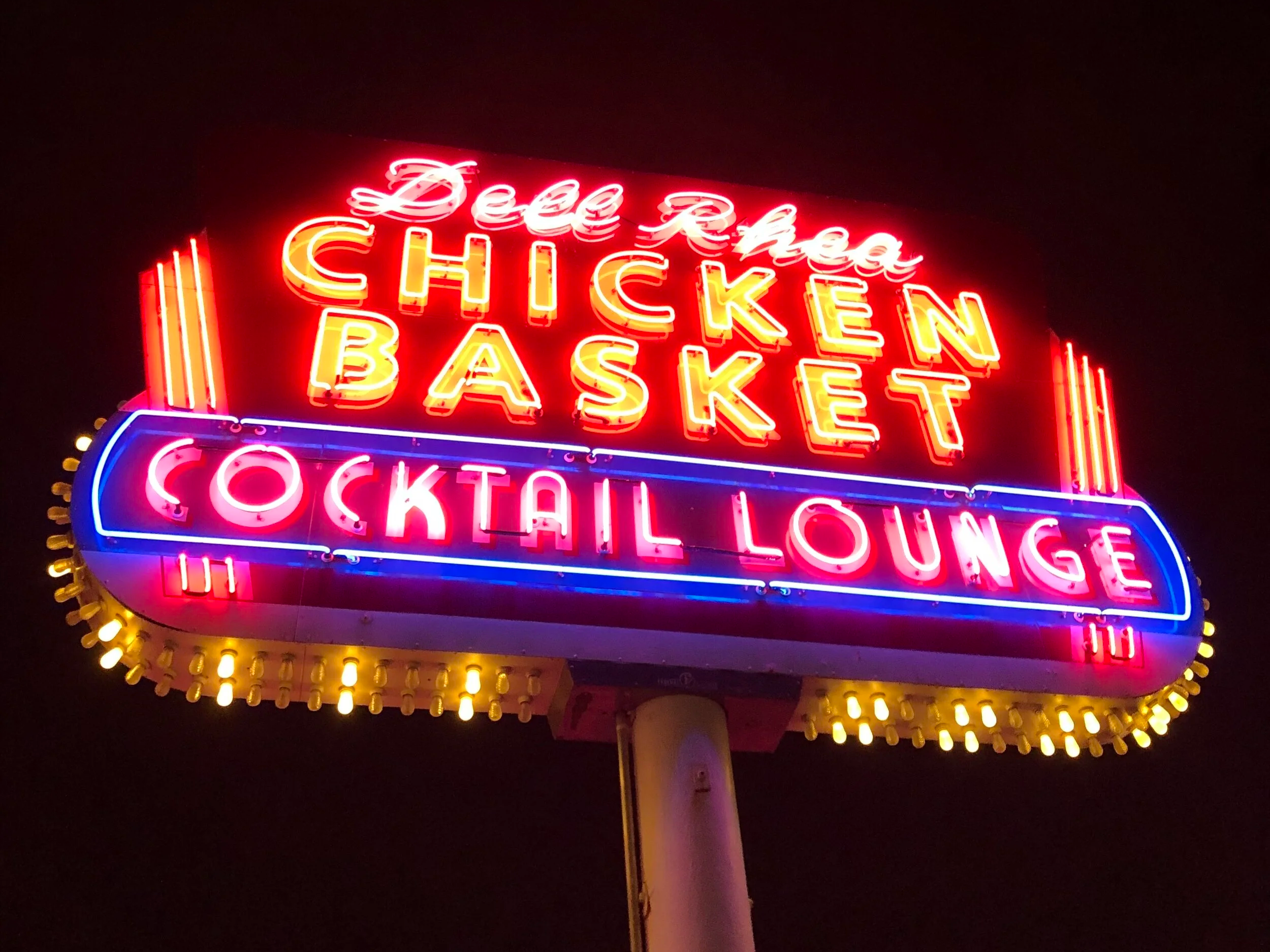
The legendary neon sign at Dell Rhea’s Chicken Basket.
After arriving in Chicago, my buddy and I checked in to our hotel, got some rest, visited the Hard Rock Café in the city, and then made the best possible choice for dinner.
One of the best places to eat on Route 66 is Dell Rhea’s Chicken Basket. The neon sign is legendary—very hard to miss—and the fried chicken is amazing. But the Chicken Basket didn’t always serve chicken. Initially, it operated as a simple lunch counter. In the late 1930s, two farm women offered to sell the owner their farm’s eggs, along with their fried chicken recipe. Locals and travelers have been worshipping the succulent, crispy fried chicken and fried mac-and-cheese balls ever since. Don’t miss this one on your trip along Route 66!
Day 10: Chicago, Illinois
Field Museum of Natural History

The Field Museum of Natural History, home of Sue the T. rex.
The Field Museum of Natural History in Chicago may be one of the few attractions known as much for what it doesn’t display as for what it does. The museum’s library holds 250,000 volumes on the history of the earth and more than 20 million curios from around the world, each cataloged and set aside for study when not on display. Like that of many Chicago museums and landmarks, the Field Museum’s inception coincided with the 1893 World’s Columbian Exposition.
In 2000, the museum garnered international attention when it debuted Sue, the largest, most complete, and best-preserved Tyrannosaurus rex fossil ever discovered. Several other permanent exhibits exploring Africa and Asia trace those continents’ culture and environment with life-size dioramas. The museum regularly unveils new items and collections, and special events bring regular visitors back for another helping.
Millennium Park and Cloud Gate

Cloud Gate reflecting the Chicago skyline.
Within walking distance of the Field Museum and the Buckingham Fountain, Millennium Park is a green-space oasis in the middle of a bustling metropolis. You’ll find Cloud Gate there. Sculpted by Mumbai’s Anish Kapoor, it looks like a giant polished-chrome… jellybean? But that description doesn’t do it justice. The sculpture was blocked off due to COVID-19 when I visited; however, its curves reflect the sky and, typically, the groups of people gathered around it.
The images are distorted in surprisingly beautiful ways as you pass by the gate. It’s one of the city’s most popular photo ops, and one you certainly do not want to miss.
The “Begin Route 66” Sign
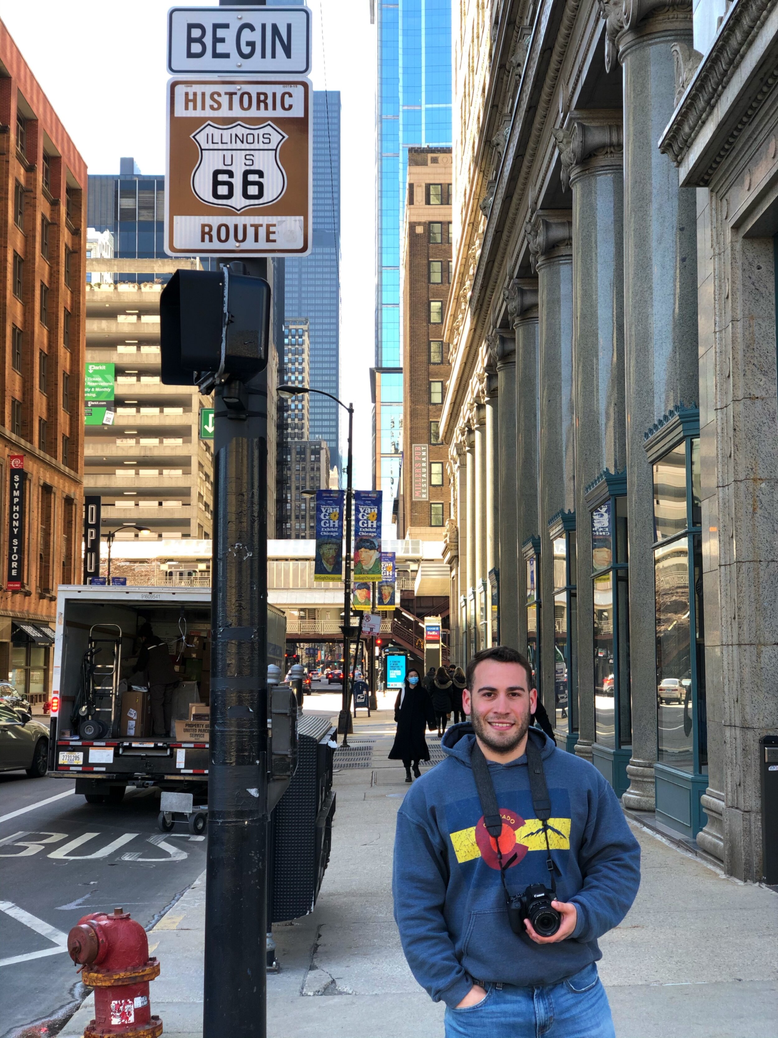
Me at the “Begin Route 66” sign in Chicago: the end of my trip and the start of the route.
It’s been quite the adventure, but it has finally come to an end. Or is it the beginning? As a reminder, we’ve been traveling Route 66 backward, so this is actually where the route would begin if you started in Illinois.
The specific starting point for Route 66 has moved several times. The 1926 alignment was at Jackson Boulevard and Michigan Avenue, near the Art Institute of Chicago. In 1933, the start of Route 66 moved a couple of blocks east to Jackson Boulevard and Lake Shore Drive, near the World’s Fair. Then, in 1955, Jackson became a one-way street heading eastbound; Adams Street, one block north, became the new westbound starting point for Route 66. Across the street from the Art Institute at Michigan Avenue and Adams, you can spot the historic “Begin Route 66” sign.
So what do you say? Let’s give it another go, this time from Chicago to Santa Monica? Let’s refuel first, though. Head to Lou Malnati’s Pizzeria for some legendary Chicago Deep-Dish Pizza.
What Ten Days on Route 66 Taught Me
Route 66 is blessed with rich history, the stories shared by the people along the way, and the expectation that every traveler will rediscover themselves on the open road. I experienced ten days of oddities and charm that cast a warm light on places I never knew were part of America. I slept in a car with my best friend, was uncomfortable at times, and ripped a few socks from so much walking on the trip, but traveling with so much freedom was a transformative experience I will always appreciate. I hope many others get to experience a trip like this, and that’s the biggest reason I prepared this guide. I wish I had more time and infinite funds to experience Route 66 more fully, but ten days was still enough to see so many new things and create new memories.
Some of the poems in my collection Bittersweet were inspired by, or even written on, this trip, so a piece of Route 66 will always live in its pages. And if a trip like this is on your list, it’s exactly what I mean when I say to live a life worth writing about.
The Guidebook I Used

Moon Route 66 Road Trip (Travel Guide) by Jessica Dunham
If you have more time than I did, I recommend getting a copy of Jessica Dunham’s Moon Route 66 Road Trip. I couldn’t have planned a trip as detailed as mine without that guide, and many of the descriptions in this post come from her work. She provides hundreds of additional experiences and sites along Route 66, so if you have more time or plan to redo the road trip at some point, her guide is essential.
If you’re looking for a decent camera to capture your memories, I recommend the one I use: the Canon EOS Rebel SL3.
Anyways, thank you for reading this far. I wish you safe travels, and I hope you make memories that last a lifetime.
Frequently Asked Questions
How long is Route 66?
Route 66 in the United States runs 2,448 miles (3,939 km) from Chicago, Illinois, to Santa Monica, California.
Can you drive Route 66 in 10 days?
You could drive down Route 66 for a month and still have things left to do when you’re done, but ten days is still enough time to experience so many new things and create new memories.
Where is the “Begin Route 66” sign in Chicago?
Across the street from the Art Institute at Michigan Avenue and Adams, you can spot the historic “Begin Route 66” sign.
Are you a writer in need of inspiration?

Meet the author
Born in Caguas, Puerto Rico, raised in a military family, and a former U.S. Marine. Pablo Camacho is the author of more than eight books in English and Spanish, including the Pencraft Award–winning Bittersweet, and is currently writing his first horror stories. He lives in Florida with his wife and daughter.

Reading and learning are critical for living a life worth writing about. Discover a massive catalog of books, including some of mine, on Kindle Unlimited. Try Kindle Unlimited free.